Ancient Deed and Historical Research
Robert Yarumian and I were expert witnesses on opposite side of a boundary dispute - so we obviously had different opinions. However, when asked under oath what I thought of Mr. Yarumian and his work, it was a pleasure to state that he is one of the most competent, meticulous, thorough, and knowledgeable surveyors I know.” “I think Mr. Yarumian is probably one of the finest surveyors in this State without question. He does meticulous work. His work is detailed. He is a good experienced surveyor.
Knud E. Hermansen, P.L.S., P.E., Ph.D., Esq.
Professor UMO
(while on the witness stand of
an opposing court case. )
Maine Boundary Consultants has the experience in performing Ancient Deed and Historical Research. In Maine, the task of tracing the deed history of a parcel of land back in time to the creation of each boundary line can be very challenging and complicated. Many boundary lines were created back in the early 1800’s or 1700’s. To perform an accurate Boundary Survey a good understanding of when and how each boundary line was created is very important, especially if the current deed is an “abutters description”. An abutters description is a deed which mentions only the names of the abutting or adjoining landowners. Ancient Deed and Historical Research takes great skill that requires many years of experience that relatively few people have attained. The challenge is to piece together this multidimensional puzzle, which requires space and time. The results of an Ancient Deed research investigation is a Deed Chain identifying the owners and the parcels from the current owners back in time to the original land grants.
Maine Boundary Consultants has worked on several unique Historical Research projects such as the 1990 Road Research Project for the Town of Buxton. During this project all the Proprietors, Town, County and State Road records were analyzed to determine what records belong to what section of existing Town Roads. Well over 2000 record documents were analyzed. The results were a Road Map for all of the roads in the Town of Buxton and a 250+ page Report identifying the each of the records for over 150 Town Roads. The biggest benefit was the determination of the width for all of the Town Roads.
In 1998 Maine Boundary Consultants prepared a Bicentennial Map for the Town of Hollis showing the Original Rights Divisions and Land Grants between 1667 and 1809. This map was for the entire Town of Hollis which pieced together about a dozen Ancient Maps and identifies about 800 original parcels of land before 1809. This map was printed and published, in a Bicentennial Book, Calendar, and large wall map, being sold by the Town of Hollis and the Buxton - Hollis Historical Society.
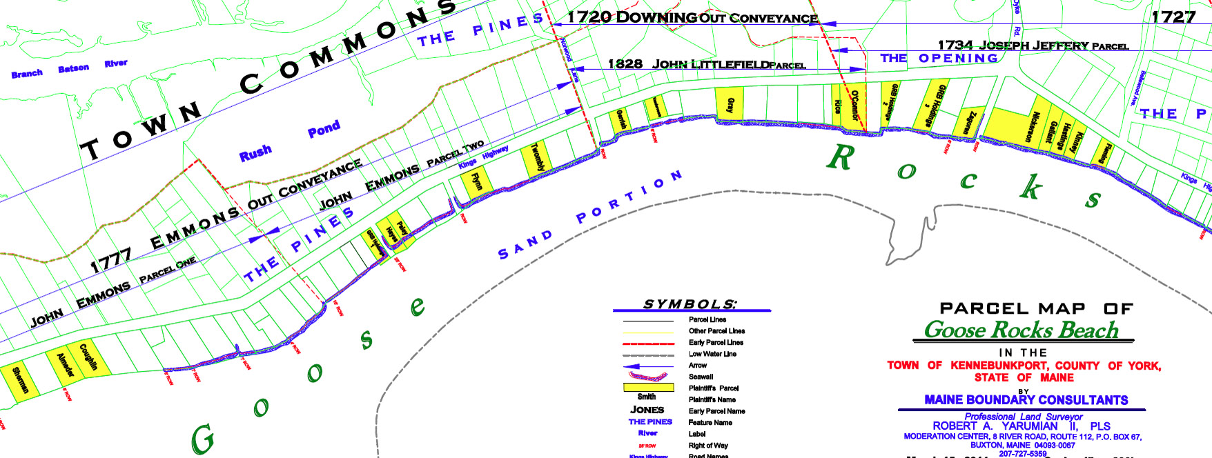
More recently, Maine Boundary Consultants has performed an exhaustive deed research investigation in the Goose Rocks Beach area of Kennebunkport, dating back to the mid-1600’s. (View Goose Rocks Beach Map). Also, we recently traced a parcel of land at Wells Beach all the way back to Book 1, Page 1, of the York County Registry of Deeds!