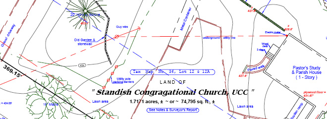
Topographical - Existing Conditions Survey
Commercial Clients:
- Airports
- Banks
- Contractors
- Developers
- Aerial Photographic Companies
- Business and Commercial Landowner
Maine Boundary Consultants has performed Topographical & Existing Conditions Surveys for many different clients. Usually this type of land survey work is done for a client that is planning some sort of development. A Topographical & Existing Conditions Survey involves identifying natural and man-made physical features such as buildings, fences, drainage, parking, driveways, impervious features, as well as the contours of the land. There are many reasons for this type of survey, including but not limited to potential development and or improvements requiring architectural or engineering work.
The results of a Topographical & Existing Conditions Survey is a detailed drawing or plan. Some Topographical & Existing Conditions Surveys include a Boundary Survey for the perimeter boundaries. Our “colored” Topographical & Existing Conditions Survey plans make the results easily readable.